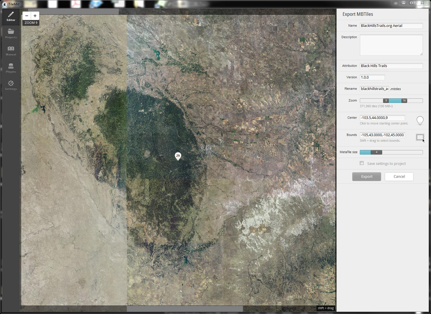
Generating aerial tiles from NAIP imagery
So you need to create your own aerial imagery tiles for a web slippy map project do you?
So you need to create your own aerial imagery tiles for a web slippy map project do you?
Distances (in miles) have been added to all of the maps and descriptions on the website. For trail networks without a specific route, such as …
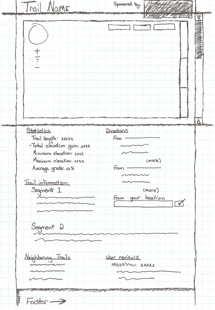
The sketch below was a concept done in late 2010 prior to the network/trail pages actually being implemented. While this website may be a modern version of a printed guide book, many facets of the site still have origins on paper.
It most certainly needs a few edits, but Trail #40 is now live. More soon.
The site got a new index page a number of days ago which may or may not be more aesthetically pleasing or easy to navigate than the previous iteration. We will continue to iterate on …
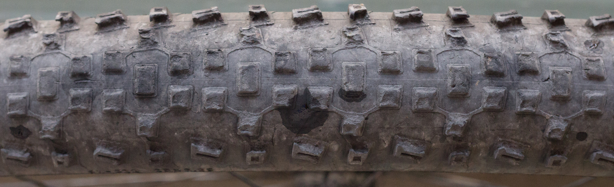
This write-up could probably also be titled, “What are the best all-around tires for riding Black Hills trails?” Tires are one of the most important equipment choices you have to make …
Download the official IMBA Trail Care Crew schedule of events for Whitewood, …